Getting around Ohio doesn’t have to mean renting a car or relying on rideshares. Whether you’re a visitor exploring the Buckeye State or a local looking for a smarter commute, Ohio’s public transportation system can be surprisingly efficient and affordable — if you know how to use it. In this 2026 guide, I’ll walk you through everything you need to know: bus routes, passes, apps, and insider tips to make your trips around Ohio stress-free. I’ve also added useful links to official sources so you can double-check routes and fares directly.
1. Understanding Ohio’s Public Transportation Network

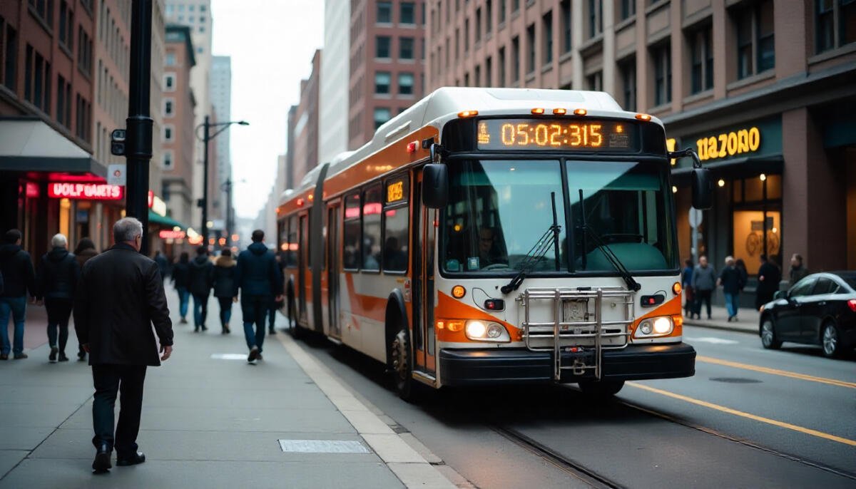
Unlike New York or Chicago, Ohio’s public transport isn’t centralized statewide. Each city or region has its own transit authority. Here’s a breakdown of the main systems you’ll likely use:
| City/Region | Transit Authority | Website |
|---|---|---|
| Columbus | Central Ohio Transit Authority (COTA) | cota.com |
| Cleveland | Greater Cleveland Regional Transit Authority (RTA) | riderta.com |
| Cincinnati | Metro Cincinnati | go-metro.com |
| Toledo | Toledo Area Regional Transit Authority (TARTA) | tarta.com |
| Dayton | Greater Dayton Regional Transit Authority | iriderta.org |
Each of these agencies operates independently, so fares, routes, and apps may differ slightly. The good news? Most of them are upgrading to smart payment options and real-time tracking in 2025.
2. How to Plan Your Trip

Before hopping on a bus or train, spend five minutes planning. Here’s what to do:
Go to your city’s transit website (linked above).
Use the “Trip Planner” tool — just enter your starting point and destination.
Download the mobile app (like COTA Plus or RTA CLE) for live bus tracking and service alerts.
Check route maps and timetables — especially if you’re traveling early morning, late night, or on weekends.
Look for day or weekly passes — usually cheaper than paying per ride.
- Tip: Google Maps and Apple Maps integrate with Ohio’s major transit systems. Just switch to the “Transit” tab for real-time bus and train schedules.
3. Fares, Passes, and Payment Options

Public transport in Ohio is generally affordable. Here’s a snapshot of what you can expect in 2025 (subject to change):
Columbus (COTA): $2 per ride; DayPass $4.50; digital fares via COTA app or smartcard.
Cleveland (RTA): $2.50 per ride; All-Day Pass $5; mobile app & contactless options.
Cincinnati (Metro): $2 per ride; 30-Day Pass $80; reloadable fare cards accepted.
Toledo (TARTA): $1.50 per ride; Weekly Pass $15; TARTA Flex app for on-demand zones.
- If you’re traveling often, get a pass — they save you money and time. Most agencies also offer discounted fares for students, seniors, and people with disabilities.
- Check each system’s fare page: RTA Fare Information
4. Major Transit Systems Explained

Columbus – Central Ohio Transit Authority (COTA)
COTA runs buses across Columbus and nearby suburbs. Their CMAX line (a Bus Rapid Transit system) connects downtown Columbus with Westerville quickly.
Download: “Transit App” or “COTA Plus” for real-time tracking.
Tip: If you’re near Ohio State University, routes are frequent and well-connected.
Cleveland – Greater Cleveland RTA
Cleveland’s RTA offers one of the most complete transit systems in Ohio, including buses, trolleys, and a light-rail train called “The Rapid.”
Website: RTA Cleveland
Special tip: Take the Red Line from Cleveland Hopkins International Airport directly downtown.
Day Pass: Perfect for tourists exploring Rock & Roll Hall of Fame, West Side Market, and the Flats.
Cincinnati – Metro Transit
Metro buses run throughout Cincinnati and nearby areas. There’s also a downtown streetcar — the Cincinnati Bell Connector — which loops around major attractions.
Website: Metro Cincinnati
Tip: The streetcar is free to ride in 2025, perfect for visitors exploring Over-the-Rhine and Fountain Square.
Toledo – TARTA
TARTA provides both fixed bus routes and flexible “TARTA Flex” services for low-demand areas.
Website: TARTA Official Site
App: “TARTA Flex” for booking on-demand rides.
Bonus Tip: The Toledo Zoo and downtown attractions are easily reachable by bus.
Dayton – RTA
The Greater Dayton RTA is unique — it still runs electric trolley buses, one of the few U.S. cities that do.
Website: Dayton RTA
Tip: Great for eco-friendly travelers and those staying near the University of Dayton.
5. Tourist-Friendly Routes and Attractions

Here’s how you can make the most of your Ohio trip using public transport:
Cleveland: Use RTA’s HealthLine BRT to visit Playhouse Square, University Circle, and the Cleveland Museum of Art.
Columbus: Take COTA Route 2 or CMAX to explore the Short North Arts District and German Village.
Cincinnati: Ride the free streetcar loop to check out Findlay Market and the Banks.
Toledo: Take a TARTA bus to the Toledo Museum of Art or the Imagination Station.
6. Safety and Accessibility
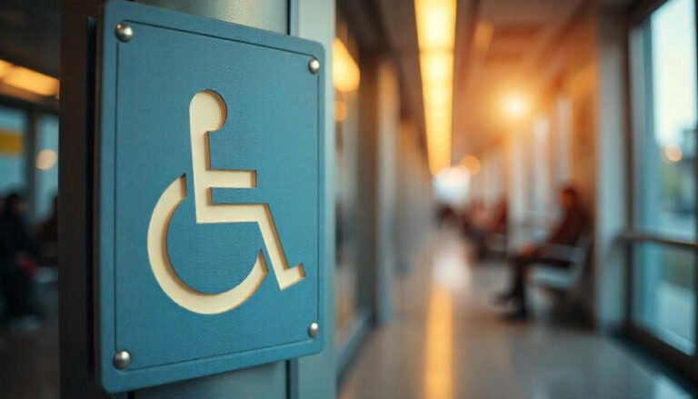
Ohio’s transit systems follow ADA guidelines, offering wheelchair access, ramps, and priority seating. Always check accessibility details on the transit website before traveling.
Avoid deserted stops at night.
Keep valuables close and stay alert.
Most major buses and stations have CCTV and staff on duty.
- If you’re unsure, ask drivers or station agents — they’re usually friendly and helpful.
7. Must-Have Apps for Ohio Transit (2025)

Download these apps before your trip for live updates and easy navigation:
Transit App – covers most Ohio cities with live bus tracking.
COTA Plus – for Columbus on-demand and fixed routes.
RTA CLE – for Cleveland train and bus updates.
TARTA Flex – book flexible rides around Toledo.
Moovit – shows multimodal travel (bus + walking + rideshare).
8. Tips from Locals
Arrive at your stop 5–10 minutes early.
Keep small bills or contactless payment ready.
Combine bike/scooter + bus for efficient travel.
During winter, check service alerts for snow delays.
For day trips, consider a multi-city bus pass or regional connection if available.
Final Thoughts
Public transport in Ohio is more convenient than many travelers expect. While it’s not as extensive as New York’s subway, it’s reliable, clean, and constantly improving. For tourists, it’s an easy way to explore major attractions without the hassle of parking or traffic. For locals, it’s an affordable and eco-friendly alternative to daily driving.
With a little planning — checking routes, downloading apps, and grabbing a day pass — you’ll move around Ohio like a pro.
Frequently Asked Questions (FAQ)
1. Is Ohio’s public transport safe for solo travelers?
Yes, especially during the day. Major systems like COTA and RTA have onboard cameras and security patrols.
2. Can I pay with cash?
Yes, but most agencies now accept mobile or contactless payments for faster boarding.
3. Do buses run at night?
Some routes in major cities like Columbus and Cleveland offer limited late-night service. Always check schedules beforehand.
4. Are there airport connections?
Yes — RTA’s Red Line connects Cleveland Airport to downtown. Columbus and Cincinnati offer airport shuttles via select routes.
5. How can tourists save money on transit?
Buy a day pass or weekly pass if you plan to take multiple trips — it’s cheaper and more convenient.